Best Hike Japan

Nasu-dake Day Hike (06Aug2017)

nasu-dake
Mt. Nasu (Nasu-dake, 那須岳): 1,917 meters, Tochigi prefecture

Hiking

The weather forecast for the day was cloudy, with rain at times. At first, we planned a hike somewhere in Yamanashi prefecture to expect Mt. Fuji view, but because of the weather forecast, we changed plans for the hike. We planned a Nasu-dake hike instead because, in case of rain when we arrived there, alternative activities for kids were relatively easily to find in Nasu area.

The weather was good?

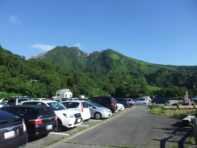
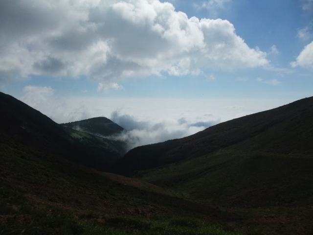
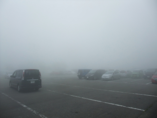
As we approached Nasu area, it started raining. It rained hard, I felt, so I was thinking about the second plan while driving. Surprisingly, it was getting sunny when we arrived at the parking lot near the trailhead. The mountaintop area was above the clouds. We saw a sea of clouds.

Minenochaya parking space
It was a fine morning when we arrived at the Minenochaya parking space.

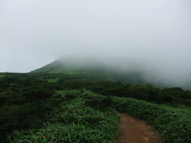
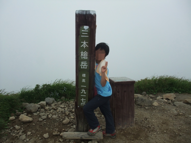
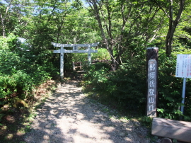
The path to the Minenochaya shelter was a gentle ascent but my daughter walked with slow pace. I wanted to walk faster because it was a late start for Nasu hiking. It is said that the weather in the mountain changes easily. I wanted to see the view from Mt. Sanbonyari. (We could not see the view clearly in 2015.)

Mt. Chausu
Mt. Chausu, the highest peak of Mt. Nasu, against the blue sky
Mt. Asahi
The shape of Mt. Asahi looked beautiful.
Minenocyaha ahead
Minenochaya shelter (a mountain hut for escape) on a mountain ridge

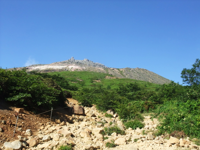
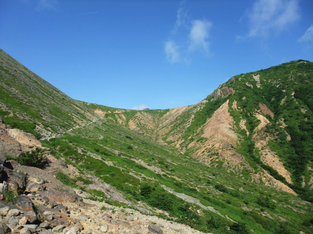
We turned around and saw a sea of clouds. It’s as if we were in another world, do you think? We also saw clouds were gathering.

a sea of clouds
We saw a sea of clouds when looked back.

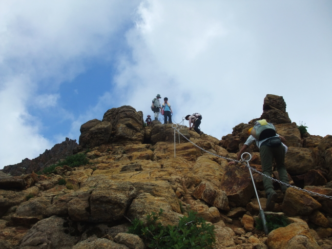
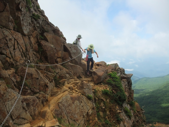
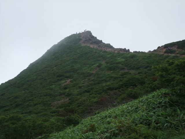
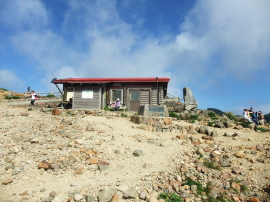
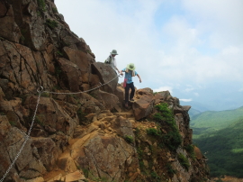
We took a short break at the Minenochaya shelter. From here, there are ups and downs, rocks and chains on the way to Mt. Asahi. Is it tough? I do not think so. It is like an outdoor obstacle course that kids can be enjoyable. Our daughter did enjoy the route to Mt. Asahi.

chain part of the routre
This is the Nasu hiking. The mountain on the left side is Mt. Chausu. The oblique line on the hillside is the trail from the trailhead to Minenochaya.
making a traverse.
This is the Nasu hiking. This is the place hikers should be more careful (but is not a tough traverse).

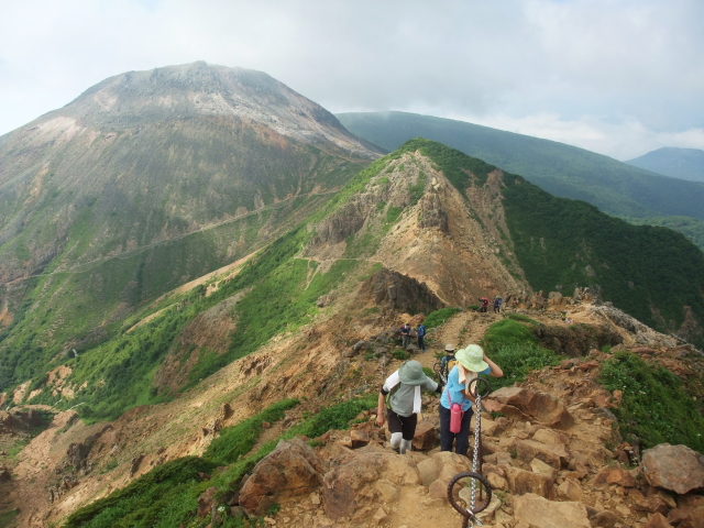
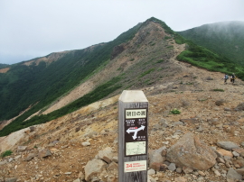
There are picnic tables at Asahi-no-kata (meaning “shoulder of Mt. Asahi”) and many hikers took break here. Mt. Asahi is only 10 minutes walk from here.

Mt. Asahi view from Asahi-no-kata
the peak of Mt. Asahi
The peak of Mt. Asahi. The scene from the peak was not able to be enjoyed because of fog.
himeshajin
Himeshajin: a family of plants of the order Campanulales. It blooms on highlands in Japan from summer to autumn. It is one of the pleasures for Nasu hiking to see plateau plants.

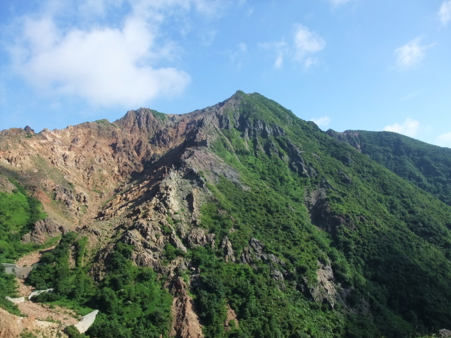
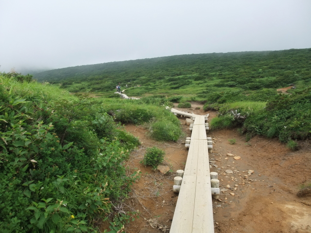
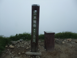
The trail to Mt. Sanbonyari is on a mountain ridge for a while. The wind is high, usually. Then, it is become a wooden path on the plateau. Our daughter walked faster because the majority of the route from Asahi-no-kata is rather flat.

a wooden path - Mt. Nasu hike
A wooden path
Mt. Sanbonyari in the coulds
Looks like the peak of Mt. Sanbonyari was in the clouds, again.
The peak of Mt. Sanbonyari
The peak of Mt. Sanbonyari was in the clouds similarity to our hike in 2015. I wonder if we can see the view at the next opportunity.

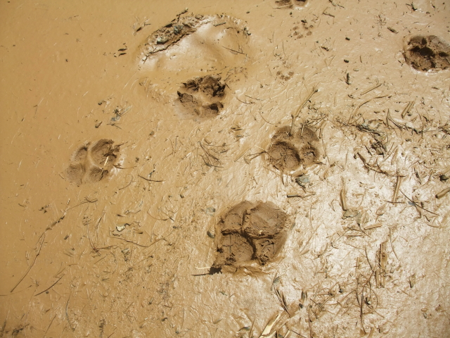
When we back to Kita Onsen branch, a hiker told me that he and his companions saw bear 5 minutes ago. They made a noise then the bear went away. “So, you should be careful!”, he said. We walked on a mountain. It is no wonder if we run into a bear in the mountain. It is a habitat of bear.

a footprint of an animal
Our daughter found a footprint of an animal close to Shimizu-daira on the way back to Asahi-no-kata. I do not know if it is the footprint of bear, though.
in the fog
The parking space was in the fog when we came back after hiking. Please compare with the first photo of this report.

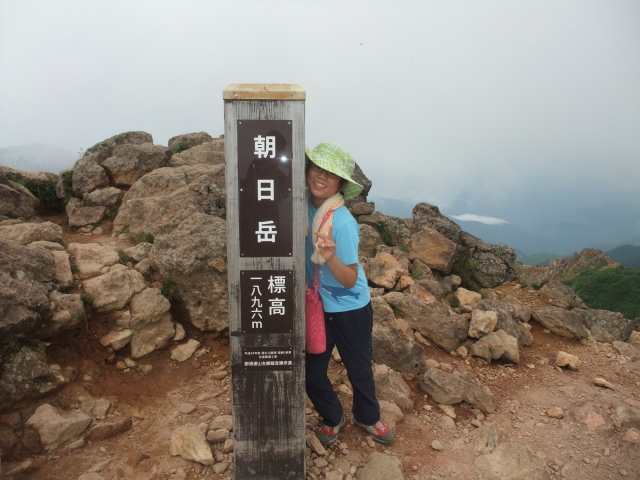
We could hardly see anything because of the fog. Although the view from the peaks was disappointing, I thought we were lucky to hike such a day. At least, it was sunny for the first half of the hike.

Route & Time

Hike date: August 6, 2017
Members: Family (farther, mother and 9-year-old daughter)
Course time:
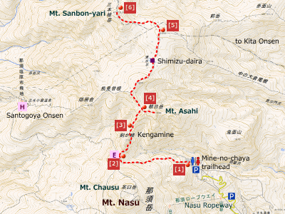
7:33 trailhead – 8:11 Minegachaya shelter 8:17 – 9:01 Mt. Asahi – 9:49 Kita Onsen junction – 10:17 Mt. Sanbon-yari 10:28 – 11:53 Minegachaya shelter – 12:24 trailhead [4 hours and 51 minutes]

nasu-route06aug2017
「国土地理院の電子地形図にマーカー及び歩行ルートを追記して掲載」
trailhead to Nasu-dake
[1] Trailhead of Nasu-dake. A ropeway is available for hikers demanding shorter walking hours (terminal is close to Mt. Chausu).
Minenochaya shelter
[2] Minegachaya shelter. It looks like a mountain hut. Hikers can enter the shelter to avoid wind.
to traverse on the mountainside
[3] Chain place on the route. Caution is required to pass but it was not so tough or dangerous even for a younger girl.
Asahi-no-kata
[4] Asahi-no-kata is a junction of two routes; one is to the peak of Mt. Asahi and the other one directs to Mt. Sanbonyari.
Kita-onsen junction
[5] Kita Onsen junction; one is to Kita Onsen and the other one is to Mt. Sanbonyari.
the peak of Mt. Sanbon-yari
[6] The peak of Mt. Sanbonyari

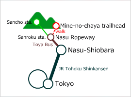
Access using public transportation

Public transportation to Mt. Nasu

Area Information

Hot bath after hiking

hot bath - image

Shikanoyu
500 yen/adult
TEL: 0287-76-3098
2 minutes walk from
Nasu-Yumoto Onsen bus stop

Category:

コメントを残す

メールアドレスが公開されることはありません。 * が付いている欄は必須項目です

このサイトはスパムを低減するために Akismet を使っています。コメントデータの処理方法の詳細はこちらをご覧ください

  • Hello!

    I noticed the beauty of Japanese nature when I went to an English language school in the US. While staying the US, I enjoyed hiking at National Parks. I wanted visitors from different countries to have a good time here in Japan as I did in the US.