Mt. Kumotori

Name in Japanese: Kumotori-yama (雲取山)
Location: Tokyo, Saitama, Yamanashi
Elevation:2,017 m
A gentle shaped and the highest mountain in Tokyo
Mt. Kumotori is a deep moluntain and has broader catchment. It is a tributary of the Arakawa and Tamagawa, in other words, it is one of the water sources of capital Tokyo. As it is a huge mountain across the neighbouring prefectures, it should be a long hike. It is a very popular mountain and there are many hikers except the dead of winter and midsummer.
Hiking
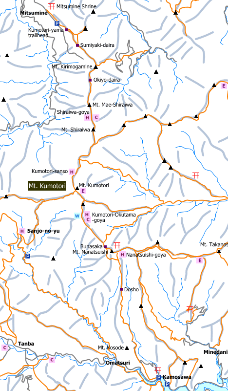
There are several routes to Mt. Kumotori. Below three routes are popular for hikers.
- Kamosawa to Mt. Kumotori: 7 hours 20 minutes (22.5 km)
- Tanba to Mt. Kumotori: 12 hours 30 minutes(27 km)
- Mitsumine Shrine to Mt. Kumotori: To be noted


Sample route
Route: From Kamosawa
Distance (round trip): 22.5 km
Distance in elevation: 1,483 m
Difficulty during the best season: intermediate level
Season for hikers: late April to early November
Route and estimated course time:
Kamosawa -[2:00]- Doudko -[1:00]- Mt. Nanatsuishi -[1:00]- Kumotori Okutama-goya -[0:30]- Mt. Kumotori -[0:20]- Kumotori Okutama-goya -[1:10]- Doudoko -[1:20]- Kamosawa [7 hours 20 minutes]
Note:
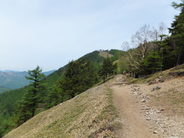
It is 12 km from the trailhead to the peak; however, it does not feel so tough.
Almost all the route is a gentle slope and it is in good condition.
As good view is expected from the camp ground close to Kumotori-Okutama mountain hut, a 2 day 1 night hike may be fun.
Hiking report

Coming soon!
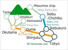
Directions

Links
JR Chuo Line
Seibu Line Limited Express Red Arrow
Nishi-Tokyo Bus
Seibu Kanko Bus
Area Information
Hot bath after hiking
![]()
Moegi-no-yu
780 yen/adult
TEL: 0428-82-7770
10-min walk from
Okutama Sta.
Hot bath after hiking
![]()
Nomekoi-yu
600 yen/adult
TEL: 0428-88-0026
close to Tanba bus stop


