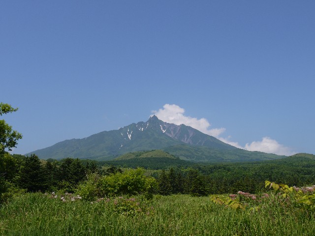
Mt. Rishiri

Location: Hokkaido
Elevation: 1,721 m
1/25000 map: Oshidomari (鴛泊)
Season for hikers: July to October
Northern beautiful mountain located off the coast of Hokkaido
As Rishiri stands for “High Island” in Ainu Language, its sharp peak rises high around the area. Mt. Rishiri is a composite volcano, and the look of the mountain is recognized as “Rishiri – Fuji” (derived from Mt. Fuji). Wide varieties of peculiar plants, which grow over 2,000 m above the sea level, bloom all over the place. It belongs to Rishiri-Rebun-Sarobetsu National Park.
Sample hiking route
Distance (round trip): 12.2 km
Distance in elevation: 1,516 m
Difficulty during the best season: intermediate level
Trailhead: Hokuroku Yaeijyo
Route and estimated course time:
Hokuroku Yaeijyo -(3:30)- Mt. Chokan -(1:50)- Mt. Rishiri -(1:30)- Mt. Chokan -(2:20)- Hokuroku Yaeijyo [9:10 in total]
Note: This is a hard hiking because the difference in elevation is more than 1,500 m. Hikers should stay around the trailhead and start hiking in the early morning.
Sample hiking route map


Hiking report
It is not available yet.
Directions
Public transportation
Haneda Airport (Tokyo) -[Airline]- Shin-Chitose Airport (Sapporo) -[Airline]- Rishiri Airport -[taxi]- Hokuroku Yaeijyo (trailhead)
Flight information/Timetable:
Haneda Airport to Shin-Chitose Airport: Big Bird
Shin-Chitose Airport to Rishiri Airport: Fly Team
Hot bath after hiking
Rishiri Fureai Onsen at Hotel Rishiri (利尻ふれあい温泉)
Fee: 550 yen/adult
Bathing time: 13:00-21:00
Telephone: 0163-84-2001


