Mt. Ontake
Name in Japanese: Ontake-san (御嶽山)
Location: Nagano, Gifu
Elevation: 3,067 m
A place of mountain worship where always having believers dressed white robes
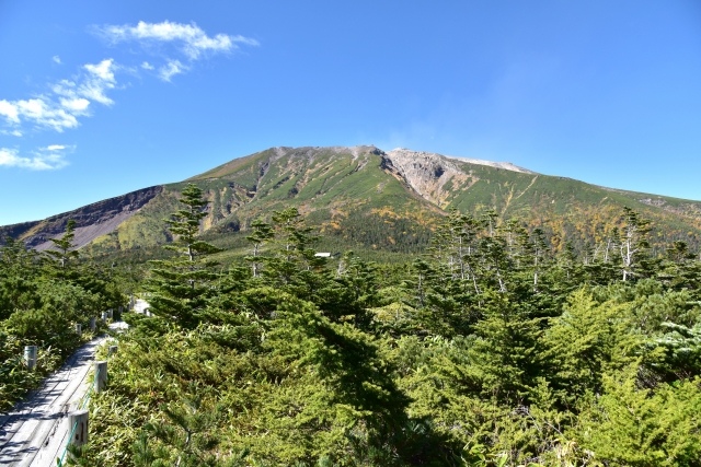
Mt. Ontake is a composite volcano and is an individual mountain with majestic view of the wide skirts. Mt. Ontake erupted in 2014 and it took the lives of so many people. It erupted in 1979 and smoke still issues from the mountain. Mt. Ontake has a long history as a place of mountain worship. At its peak in summer, lights of believers continues without end from the foot to the top of the mountainthrough the night.
There may be volcanic alerts in effect
Mt. Ontake is one of 47 active volcanoes covered by an “eruption alert” system that was started 04Aug2015. If you plan to hike Mt. Ontake, you should check the latest information on Volcanic Warnings (Japan Meteorological Agency).
Hiking
There are several routes to Mt. Ontake. The route shown here is one of the route before the eruption (it is not allowed to hike mountaintop area in 2016). For hikers planning to climb Mt. Ontake, please confirm the latest local information.
- Otaki-guchi route: 4 hours 45 minutes (6.6 km)
Sample route
Route: Otaki-guchi route
Distance: 6.6 km
Distance in elevation: 887 m
Difficulty during the best season: intermediate level
Season for hikers: July to October
Route and estimated course time:
Tanohara (7th step) -[2:00]- Kongo-doji (8th step) -[0:40]- Otaki-chojyo -[0:20]- Kengamine peak (Mt. Ontake) -[0:15]- Otaki-chojyo -[0:20]- Kongo-doji -[1:10]- Tanohara [4 hours 45 minutes]
Description:
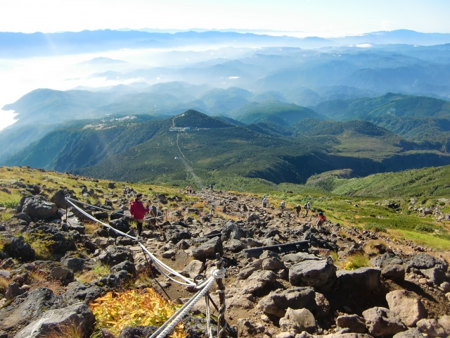
This route is popular for hikers because it is the the shortest one to the peak. Steep slope begins after passing a worship space. The smell of sulfur hung in the air around Otaki-chojyo. From Otaki-chojyo, it becomes a flat trail. When visibility is low due to dense fog, be careful not to stray from the route. In sunny day, great view of North Alps is expected from the peak. The route is good in condition.
Route map
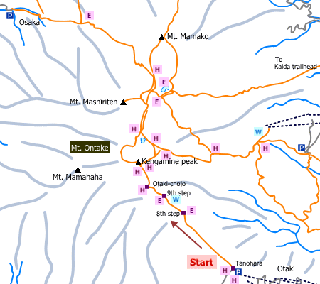

NOTE: As of end 2016, not all the mountain hut on the map is open due to the eruption in 2014.
Hiking report
It is not available yet.
Directions
Public transportation
- Otaki-guchi route: Kiso-Fukushima station -(bus)- Tanohara
Area information
Hot bath after hiking
Otaki-no-yu (御嶽温泉 王滝の湯)
Fee: 500 yen/adult
Bathing time: 12:00-19:00
Telephone: 0264-48-2454


