Mt. Miyanoura

Name in Japanese: Miyanoura-dake (宮之浦岳)
Location: Kagoshima
Elevation: 1,935 m
A big mountain rises on Yakushima Island of World Heritage
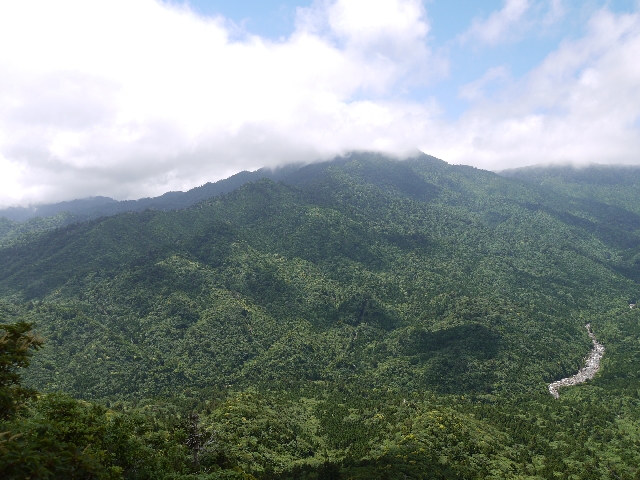
Mt. Miyanoura is the higest mountain in Kyushu resion. It has twin peaks and the west peak is higher. The mountain top provides a 360-degree view and it offers a view of famous mountains in Kyushu and Yakushima Island. The route, which passes through laurel forests, Yakushima cedars, has many highlights such as giant cedars and beautiful valleys.
Hiking
- From Yodogawa-tozanguchoi: 8 hours 05 minutes (12.8 km)
Sample route
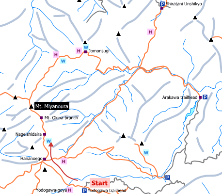
Route: From Yodogawa-tozanguchoi
Distance: 12.8 km
Distance in elevation: 575 m
Difficulty during the best season: intermediate level
Season for hikers: late March to early November
Route and estimated course time:
Yodogawa-tozanguchoi (Yodogawa trailhead) –[0:50]- Yodogawa-goya –[1:50]- Hananoego –[0:20]- Kuromidake-bunki –[0:30]- Nageishi-daira –[1:50]- Mt. Miyanoura –[1:40]- Nageishi-daira –[0:30]- Kuromidake-bunki –[0:15]- Hananoego –[1:30]- Yodogawa-goya –[0:50]- Yodogawa-tozanguchoi [8 hours 05 minutes]
Description:
It is well designed for hike until Yodogawa-goya. It becomes a steep slope to the mountain ridge and an uphill trail continues until Koubandai observation platform. Then, the trail is among the wetlands until Hananoego. It is about 20-minute hike to Kuromidake-bunki, a col on the route. On the way to Mt. Nageishi, it provides a good view. The slope to the peak of Mt. Miyanoura begins from Okinadake-bunki (branch). It is an option to fo down to Arakawa-tozanguchi (trailhead).
Route map


Hiking report
It is not available yet.
Directions
Public transportation
- Yodogawa-tozanguchoi: Awa port -(taxi)- Yodogawa-tozanguchoi
Area information
To be Noted


