Mt. Kirishima
Name in Japanese: Kirisima-yama (霧島山)
Location: Kagoshima, Miyazaki
Elevation: 1,700 m
The highest peak of Kirishima volcanic belt
Mt. Kirishima is a general term of 20 volcanos. The highest peak is Mt. Karakuni. The peak of Mt. Kirishima provide a distant view of Kirishima Mountains and a view of lots of explosion craters. The route is easy even for hikers in beginner level and many tourists visit the mountain when rhododendron kiusianum blooms. There are many hot springs at the foot of Mt. Kirishima.
Hiking
- From Ebino-kogen: 2 hours 35 minutes (5.6 km)
Sample route
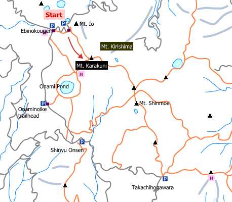
Route: From Ebino-kogen
Distance: 5.6 km
Distance in elevation: 510 m
Difficulty during the best season: beginner level
Season for hikers: April to November
Route and estimated course time:
Ebino-kogen –[1:40]- Mt. Kirisima –[0:55]- Ebino-kogen [2 hours 35 minutes]
Description:
The route starts with the smell of sulfur hung in the air. The field of vision is widely opened when you pass through bush area. The route is among volcanic lapilli from around the 7th station. The last part of the trail is a gentle slope. From the peak, Kirishima Mountains such as Mt. Takashiho can be seen.
Route map


Hiking report
It is not available yet.
Directions
Public transportation
- Ebino-kogen: Kobayashi station -(bus)- Ebino-kogen
Area information
To be Noted


