Mt. Hinata

Name in Japanese: Hinata-yama (日向山)
Location: Yamanashi
Elevation:1,660 m
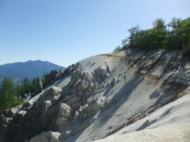
White sands on the mountaintop area – you will encounter an unusual scenery on the top of the mountain.
Mt. Hinata is the mountain that even beginners and children can hike and see the great view of surrounding mountains from the peak. The best season for hiking is mid-May to mid-June and October to mid-November. Many hikers visit Mt. Hinata to see mountains with fresh green in the spring and colored leaves in the fall.
A hiking plan
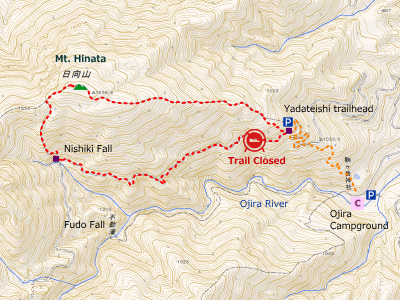
Yadateishi tozanguchi (trailhead) -[1:30]- Mt. Hinata -[1:00]- Yadateishi tozanguchi [2 hours 30 minutes]

(NOTE: A popular circular course passing Nishiki Fall is closed as of May 2017, due to fall of rocks.)
Hiking Info.
Distance: 3.8 km
Distance in elevation: 550 m
Best season for hikers: mid-May to mid-June / October to mid-November
Summary of the course:
The route is on a ridge and easy to walk even for beginners. It starts with a gentle slope among trees. There is a bench after about 1-hour walking. It once becomes a downhill way, then it turns to a uphill way again. After walking for a while, you will see white sands. Views of Mt. Kaikomagatake and Yatsugatake Mountains are expected from the peak. Keep away from cliff on the mountaintop because weathered granite is breakable.
Hiking report
None
How to get there
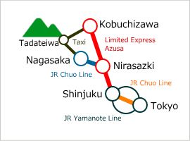
It is recommended to use a car to get to Yadateishi. Parking space at Yadateishi is limited, so you better arrive there in the early morning.
No bus is running to Yadateishi. If you want to use public transportation, taxi from Kobuchizawa Station (about 20-minute ride) is an option.

Map around Mt. Hinata
Area Information
Hot bath after hiking
![]()
Ojira-no-yu
820 yen/adult
TEL: 0551-35-2800
10-min taxi ride
from Kobuchizawa Sta.


