Akagi-san Day Hike (11Sep2011)
Hiking
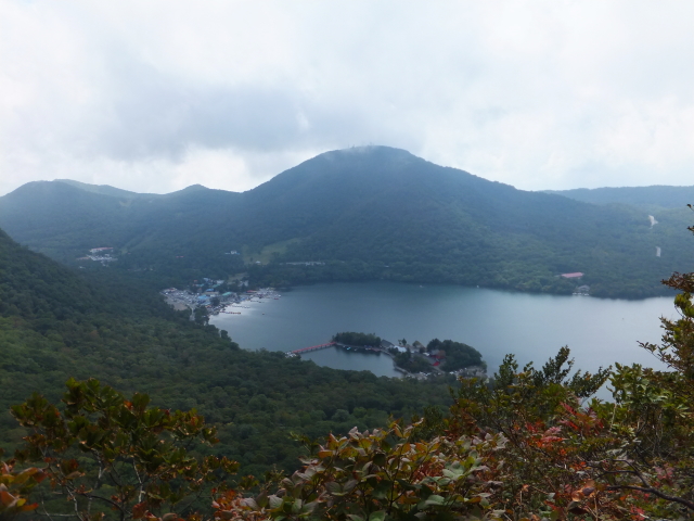
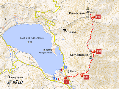
I planned to hike Akagi-san. Akagi-san seemed relatively easy to hike because the trail to Kurobi-san, the highest peak of Akagi-san, was a rather short distance from trailhead. Besides, I wanted to take pictures from a good photo spot around ‘Nekoiwa’…
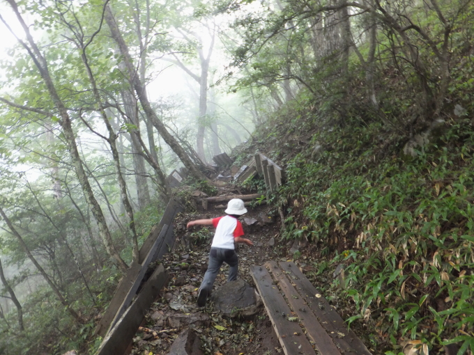
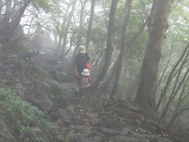
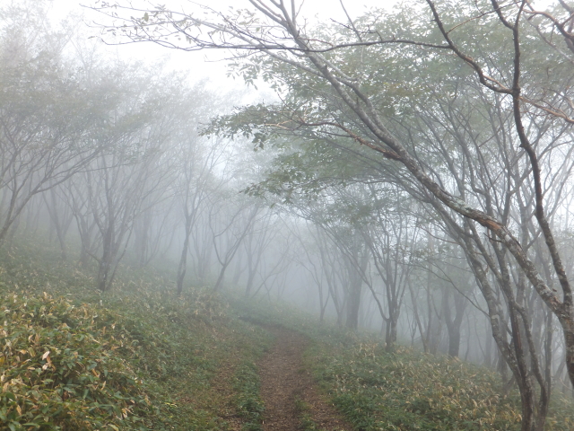
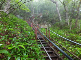
In the fog
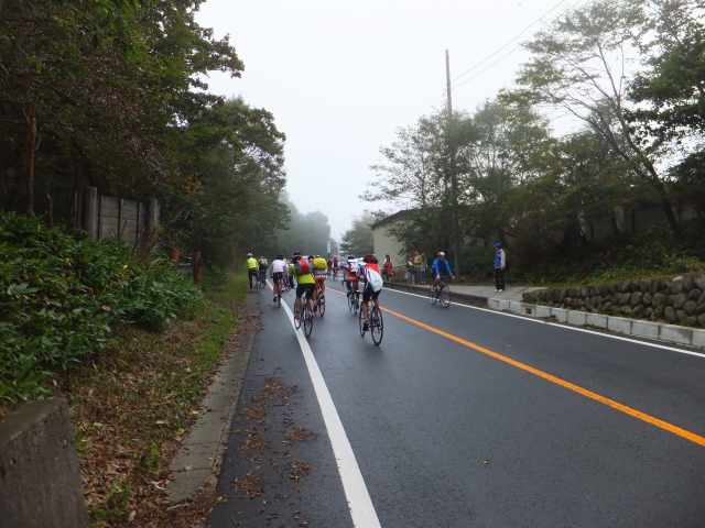
There were two unexpected occurrences before hiking. The road to the trailhead was closed due to a bike race. Such Information was not shown in the website of local government, Maebashi City, when I checked it the day before the hike. We drove around this way and that, not knowing which road was opened for cars. As the result, we spent 1 hour and half before hiking. The second unexpected thing was a weather forecast. It should have been a sunny day but it was raining before arriving at the parking space.
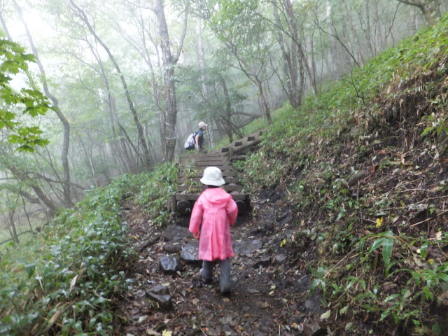
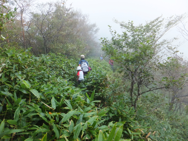
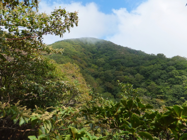
After about 1 hour walking, we were on a mountain ridge continuing to Mt. Komagatake and Mt. Kurobi. The fog blotted out mountains we were heading.
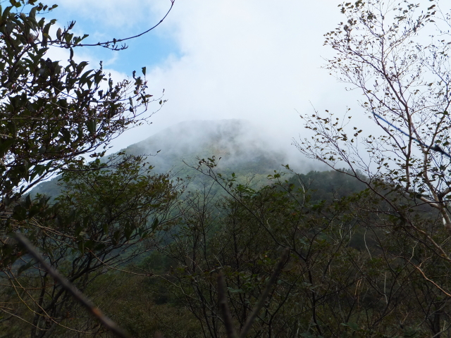
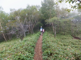
The thick fog was thinning after passing Mt. Komagatake.
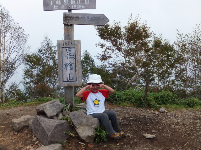
We finally arrived at the peak of Akagi-san. It took 2 hours and 45 minutes while estimated time was 2 hours and 15 minutes according to a guide book. It was not bad because my daughter was 3 years old. She did her best, I think, as always.
From Krobi-san, I went down to ‘Nekoiwa’ to take pictures. ‘Nekoiwa’ is a good photo spot for Jizo-dake with Lake Onuma and Akagi Shrine. My daughter and my wife went back to the trailhead (Komagatake tozanguchi). I had to go down to ‘Nekoiwa’, then had to go up to Kurobi-san again and run my family after later.
I could not catch up with my family on the trail. When I met them at the parking lot, they ate ice cream.
“Dad, you are too late. As a penalty, you can’t eat ice cream.”
Route & Time
Hike date: September 11, 2011
Members: Family (farther, mother and 3-year-old daughter)
Course time:
9:45 Komagatake tozanguchi (trailhead) – 10:48 on the mountain ridge (had light meal) 11:01 – 11:12 Mt. Komagatake – 12:30 Mt. Kurobi
My daughter and my wife: 12:45 Mt. Kurobi – 14:32 Komagatake tozanguchi [4 hours and 47 minutes]
Myself (farther): 12:40 Mt. Kurobi – 13:03 around ‘Nekoiwa’ 13:13 – 13:45 Mt. Kurobi 13:48 – 14:55 Komagatake tozanguchi
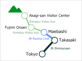
Access using public transportation
Area Information
Hot bath after hiking
![]()
Fujimi Onsen
510 yen/adult
TEL: 027-230-5555
in front of the bus stop
Sights
![]()
Akagi Shrine
Unknown when
it was established
Moved the current
location in 806


