Mt. Amagi
Name in Japanese: Amagi-san (天城山)
Location: Shizuoka
Elevation:1,406 m
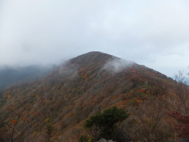
A mountain with beech forest located in the Izu Peninsula
Mt. Amagi is a general name of a couple of moutains which are belong to Izu Mountains. Mt. Bansaburo is the highest peak of Mt. Amagi. It has a gentle slope that is covered with beech forest. The route to the peak is relatively easy. The mountain peak commands a view of a widlness of waters and a view of Mt. Fuji.
Hiking
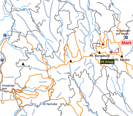
There are several routes to Mt. Amagi. Two routes shown here.
- Shakunage route: 4 hours 20 minutes (7.8 km)
- Amagi Juso route: 6 hours 30 minutes (15 km; Amagi-toge –> Mt. Amagi –> Amagi-kogen golf course)
Sample route
Route: Shakunage route
Distance (round trip): 7.8 km
Distance in elevation: 361 m
Difficulty during the best season: beginner level
Season for hikers: April to late November
Route and estimated course time:
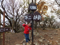
Amagi-kogen golf course -[1:05]- Mt. Banjiro -[1:10]- Mt. Bansaburo -[2:05]- Amagi-kogen golf course [4 hours 20 minutes]
Description:
This route is called shakunage route because there is most colony of rhododendron (‘shakunage’ in Japanese) on the northern slope. This route is a popular for hikers because it is shortest and the elevation difference between the trailhead and the peak is only 361 meters. The route is in a good condition and there is no dangerous point on the route. On sunny day, view of Mt. Fuji and Pacific Ocean is expected from the slightly west of Mt. Banjiro. If you want to enjoy the nature of Mt. Amagi, it is recommended to hike Amagi Juso route.
Route map

Hiking report
Coming soon!
Directions
Public transportation
- Shakunage route: Ito station – Amagi-kogen golf course (Amagi-kogen Tokyu shuttle bus)
- Amagi Juso route: Shuzenji station – Amagi-toge (Tokai bus)
Area information
Hot bath after hiking
Seaside Spa (Ito Marine Town)(シーサイドスパ(伊東マリンタウン))
Fee: 1000 yen/adult
Bathing time: 10:00-22:00
Telephone: 0557-38-3811


